
DEFINING RURAL - GEOGRAPHIC TERMS AND CONCEPTS
Establishing a definition of rural poses many challenges. Rural areas share the common characteristics of comparatively few people living in an area, limited access to large cities, and considerable traveling distances to market areas for work and everyday-living activities. Over the years, public agencies and researches have used combinations of these factors to define rural areas and designate population as rural.
Some of the more commonly used definitions to designate rural areas are promulgated by agencies and organizations such as the Office of Management and Budget (OMB) or the Census Bureau. However, these classifications are far from synonymous or mutually exclusive concepts. For example, after the 2003 OMB Metropolitan Areas reclassification, a majority of the Census-defined rural population now lives in Metropolitan areas. Such incongruities illustrate the complexity of relying on individual definitions for research and programmatic purposes.
Political and economic geography is another important consideration when determining the rurality of an area. The county is a commonly used a unit of geography from which to classify rural or outside metropolitan areas. In many rural areas, the county is often identified in terms of political, social, and economic contexts. However, county-based designations are not the optimum criteria on which to base a rural definition. Large counties, particularly in the Western United States, may dilute or mask rural population given their geographic size and influence.
HAC's Rural & Small Town Tract Designation
Given the changes and shortcomings to traditional definitions used to identify rural areas, HAC developed a sub-county designation of rural and small-town areas which incorporates measures of housing density and commuting at the Census tract level to establish a more precise measure of rural character. This alternative residence definition includes six classifications: 1) rural, 2) small-town, 3) exurban, 4) outer suburban, 5) inner suburban, and 6) urban.
The HAC rural tract classifications are specifically defined by the following characteristics.
1 = Rural tract – Less than 16 housing units per square mile (.025 housing units per acre).
2 = Small-town tract – Sixteen to 64 housing units per square mile (.025 to 0.1 housing units per acre), and a low degree of commuting to a metropolitan core area identified by a USDA ERS designated "Rural Urban Commuting Area Code" (RUCA) score of 4 or higher.
3 = Exurban tract - Sixteen to 64 units per square mile (.025 to 0.1 housing units per acre) and a high degree of commuting to a metropolitan core area identified by a USDA ERS Rural Urban Commuting Area Code (RUCA) score of 3 or lower.
4 = Outer Suburban tract – 65 to 640 housing units per square mile. (0.1 to 1.0 housing units per acre).
5 = Inner Suburban tract – 641 to 1,600 housing units per square mile. (1.1 to 2.5 housing units per acre).
6 = Urban tract - More than 1,600 housing units per square mile (2.5 housing units per acre).
For simplicity, these designations are often collapsed into 3 general classifications of: 1) small town and rural tracts, 2) suburban and exurban tracts, and 3) urban tracts.
USDA Economic Research Service (ERS) Rural-Urban Commuting Area Codes IV
The Rural-Urban commuting area (RUCA) codes, a detailed and flexible scheme for delineating sub-county components of the U.S. settlement system developed by the U.S. Department of Agriculture's Economic Research Service (ERS). RUCA codes are based on the same theoretical concepts used by the Office of Management and Budget (OMB) to define county-level metropolitan and micropolitan areas. ERS applied similar criteria to measures of population density, urbanization, and daily commuting to identify urban cores and adjacent territory that is economically integrated with those cores. ERS adopted OMB's metropolitan and micropolitan terminology to highlight the underlying connectedness between the two classification systems. However, the use of census tracts instead of counties as building blocks for RUCA codes provides a different and more detailed geographic pattern of settlement classification. Census tracts are used because they are the smallest geographic building block for which reliable commuting data are available.
County (or Statistically Equivalent Entity) V
The primary legal divisions of most states are termed ''counties.'' In Louisiana, these divisions are known as parishes. In Alaska, which has no counties, the statistically equivalent entities are census areas, cities and boroughs (as in Juneau City and Borough), a municipalities (Anchorage), and organized boroughs. Census areas are delineated cooperatively for data presentation purposes by the state of Alaska and the U.S. Census Bureau. In four states (Maryland, Missouri, Nevada, and Virginia), there are one or more incorporated places that are independent of any county organization and thus constitute primary divisions of their states; these incorporated places are known as ''independent cities'' and are treated as equivalent to counties for data presentation purposes. (In some data presentations, they may be treated as county subdivisions and places.) The District of Columbia has no primary divisions, and the entire area is considered equivalent to a county for data presentation purposes.
Census Tracts VI
Census Tracts are small, relatively permanent statistical subdivisions of a county or equivalent entity that are updated by local participants prior to each decennial census as part of the Census Bureau's Participant Statistical Areas Program. The Census Bureau delineates census tracts in situations where no local participant existed or where state, local, or tribal governments declined to participate. The primary purpose of census tracts is to provide a stable set of geographic units for the presentation of statistical data.
Census tracts generally have a population size between 1,200 and 8,000 people, with an optimum size of 4,000 people. A census tract usually covers a contiguous area; however, the spatial size of census tracts varies widely depending on the density of settlement. Census tract boundaries are delineated with the intention of being maintained over a long time so that statistical comparisons can be made from census to census. Census tracts occasionally are split due to population growth or merged as a result of substantial population decline.
Census tract boundaries generally follow visible and identifiable features. They may follow nonvisible legal boundaries, such as minor civil division (MCD) or incorporated place boundaries in some states and situations, to allow for census-tract-to-governmental-unit relationships where the governmental boundaries tend to remain unchanged between censuses. State and county boundaries always are census tract boundaries in the standard census geographic hierarchy.
ENDNOTES
-
* IV
Excerpted from UDSA Economic Research Service: Rural-Urban Commuting Area Codes.
http://www.ers.usda.gov/data-products/rural-urban-commuting-area-codes.aspx -
* V
Excerpted from U.S. Census Bureau: Geographic Terms and Concepts – or Statistically Equivalent Entity
http://www.census.gov/geo/www/2010census/gtc/gtc_cou.html -
* VI
Excerpted from U.S. Census Bureau: Geographic Terms and Concepts – Census Tracts
http://www.census.gov/geo/www/2010census/gtc/gtc_ct.html
About the Data
For a detailed analysis
of rural housing conditions download
HAC'S TAKING STOCK Report & Maps

Download Entire Report
Download By Section
National ConditionsRegional Analysis Appendices
Download Maps:
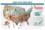 Poverty in the United States